A neighbor's guide to living near the water

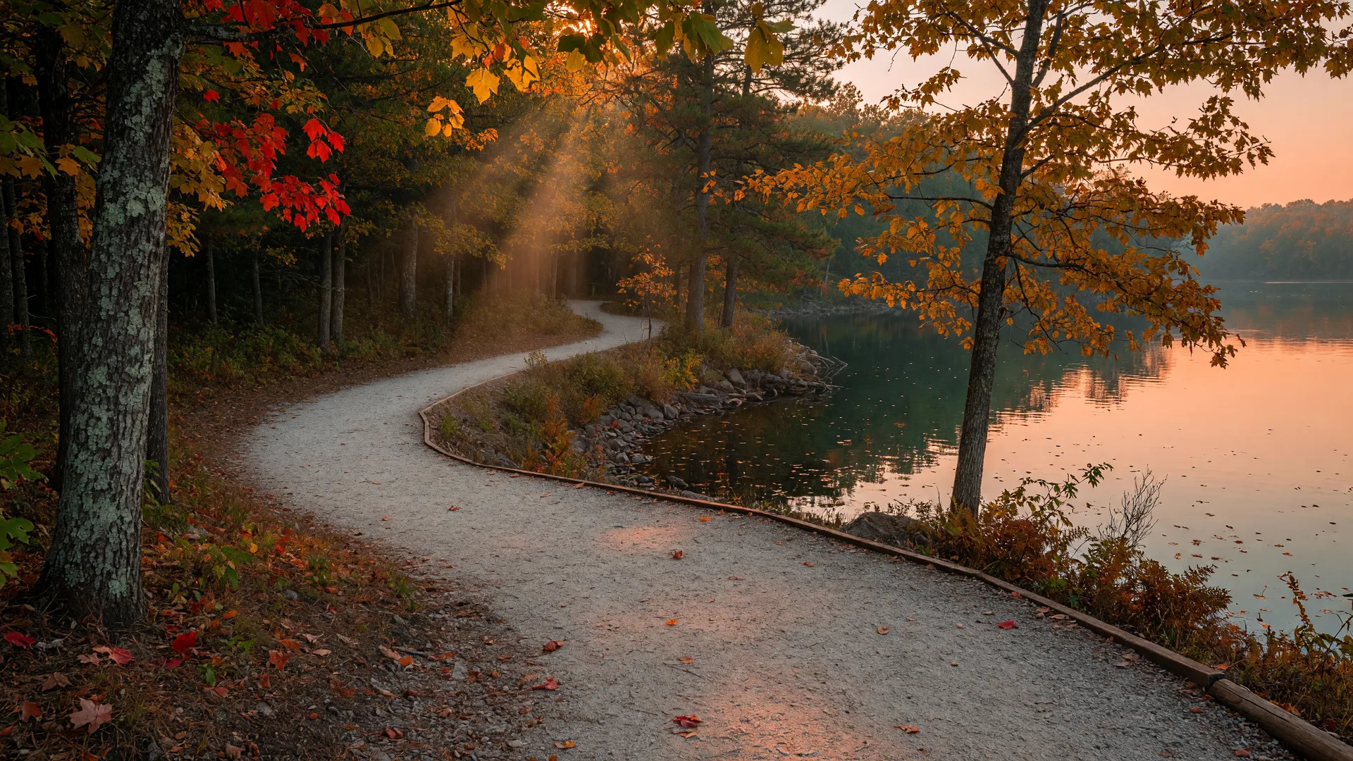
A wooded hiking trail winding along a Minnesota lake shore in autumn

Get Outside

Walking & Hiking in Washington County

The neighbor's guide to the trails, lakefront paths, and quiet woods of Washington County, Minnesota. Every spot below is a genuine public trail or park, checked against the county parks department, the Minnesota DNR, the Wisconsin DNR, and the National Park Service, with details on what each walk is like, roughly how long it is, and where to park.

A county made for walking

Washington County is one of the easiest places in the metro to get out for a walk. The old railroad grades are now long, flat, paved rail trails that cross the county from St. Paul to Stillwater and from Hugo to Forest Lake. The county park reserves keep thousands of acres of woods, prairie, and shoreline open, and the state parks along the St. Croix River hold the best bluff hikes in the region. On top of all that, the lake towns have built lakefront paths you can step onto from downtown.

This page is organized by town, starting with the big paved trails that tie the whole area together, then the walks closest to each community. Lengths and surfaces come from the managing agency, and fee notes are only included where a permit or sticker is actually required. If a detail could not be verified, it was left out.

Quick picks at a glance

Spot What it is Length & surface Best for
Gateway State TrailPaved rail trail, St. Paul to Pine Point18 miles, paved, levelLong easy walks & bikes
Brown's Creek State TrailPaved rail trail from downtown Stillwater5.9 miles, paved, levelEasy river-town ramble
Hardwood Creek Regional TrailPaved trail, Hugo to Forest Lake9.5 miles, pavedFlat walking north of the metro
St. Croix River Crossing LoopPaved loop across two bridges4.7 miles, pavedRiver views from Stillwater
Mark Sather Trail, White Bear LakePaved lakefront path2.5 miles, paved, flatLakeside stroll with views
Katherine Abbott Park, MahtomediCity park with ponds and woods~0.9-mile loop, crushed rockEasy family woods walk
Lake Elmo Park ReserveCounty park reserve15-20 miles, mixed surfaceLong hikes, bikes, swim pond
William O'Brien State ParkState park on the St. Croix~12 miles, natural surfaceWooded river-valley hikes
Willow River State Park, HudsonWisconsin state park13 miles, natural surfaceWaterfall day trip
Crosby Farm Regional ParkMississippi riverfront park, St. Paul~6.7 miles, pavedLonger nature walks & river views
Tamarack Nature Center, White Bear TownshipNature preserve with boardwalks~4 miles, natural surfaceBirding & quiet woods

Lengths are approximate as published by the managing agency or park system; surfaces and details can change with maintenance and seasons.

The Big Paved Trails

Trails that cross the county

These are the spines of the local trail network: former railroad grades turned into long, flat, paved paths. They are free, mostly level, and open to walkers, runners, bikers, and inline skaters. In winter, keep an eye on trail conditions; the paved surfaces handle packed snow and cold-weather walks when crews have been out.

Gateway State Trail

My top pick when I want a long, easy walk I can do any day of the year. The Gateway is an 18-mile paved, multi-use rail trail on a former Soo Line railroad grade, level and generally wheelchair accessible, and just as good for running and biking as it is for walking. It starts in St. Paul on Cayuga Street, runs northeast through Maplewood, North St. Paul, and Oakdale, then crosses into Washington County through the Lake Elmo area and ends at Pine Point Regional Park, about four miles northwest of Stillwater. Trailheads along the way: Cayuga Park in St. Paul, Flicek Park in Maplewood, Rotary Park in North St. Paul, the Pine Springs trailhead just east of Hadley Avenue near Oakdale, and Jamaica Avenue, Highway 96, and Pine Point Park at the Stillwater end.

  • 18 miles, paved & level
  • St. Paul to Pine Point near Stillwater
  • Free trail; county park trailhead parking
MN DNR trail page

Brown's Creek State Trail

A paved rail trail that starts in downtown Stillwater near Laurel Street East, at the edge of the St. Croix National Scenic Riverway, and runs about 5.9 miles west through the Brown's Creek valley to a junction with the Gateway State Trail in Grant. Flat, smooth, and wheelchair accessible, it is the easiest way to pair a riverside walk with downtown Stillwater.

  • 5.9 miles, paved & level
  • Downtown Stillwater to Grant
  • Free trail; trailheads in Stillwater and Grant
MN DNR trail page

Hardwood Creek Regional Trail

Washington County's most-used regional trail: about 9.5 paved miles running north-south along Highway 61 from Hugo to Forest Lake, built on a former railroad right-of-way. At the Forest Lake end it connects to Chisago County's Sunrise Prairie Trail, so you can keep walking all the way to North Branch and beyond.

  • ~9.5 miles, paved
  • Hugo to Forest Lake
  • No vehicle permit needed on the trail itself
Washington County trail page

Sunrise Prairie Trail

The paved Chisago County rail trail that picks up where Hardwood Creek leaves off. From Forest Lake it runs about 16 miles north to North Branch and continues toward Harris, with trailheads and parking at Harris, North Branch, Stacy, and Wyoming. One trail, three counties of scenery.

  • ~16+ miles, paved
  • Forest Lake to North Branch
  • Trailhead parking at several towns
Chisago County trail page

St. Croix River Crossing Loop Trail

The best river walk in the valley. This paved loop of about 4.7 miles starts in downtown Stillwater, crosses the historic Stillwater Lift Bridge (pedestrian and bicycle only since 2017) into Houlton, Wisconsin, follows the trail through farmland along the river, then comes back across the St. Croix Crossing bridge to the Minnesota side. Wide-open river views the whole way, with the lift bridge raised for boats on summer weekends. Trailheads in Houlton include the Blue Star Trailhead at 77 Houlton School Circle and the Hilltop Trailhead at 1395 Hilltop Drive.

  • ~4.7 miles, paved loop
  • Stillwater to Houlton, WI and back
  • Free; trailhead parking in Houlton or downtown Stillwater
St. Croix County trail page

Mahtomedi & Long Lake

Mahtomedi is a walking town. The parks are close together, the streets around Long Lake are quiet, and nobody minds if you stop to watch the water.

Mahtomedi and Long Lake at sunset

Katherine Abbott Park

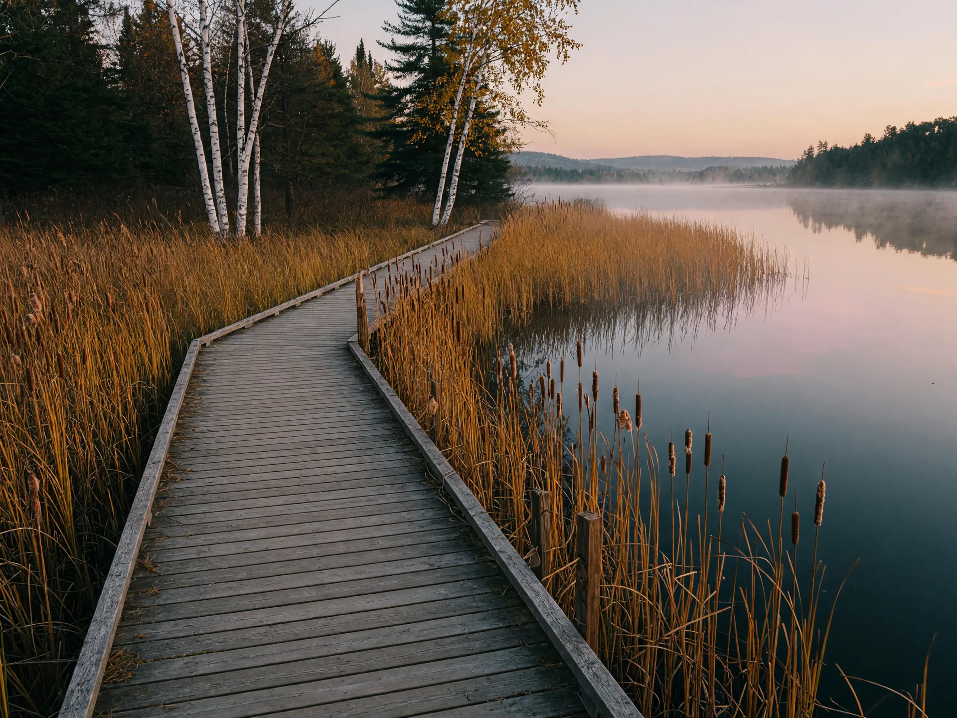
Mahtomedi's natural gem at 1000 Lincolntown Avenue: about 76 acres of ponds, woods, and rolling hills with marked walking trails. The ~0.9-mile loop on a crushed-rock path through woods and ponds is a perfect short family walk. This year the city is building a roughly 238-foot floating boardwalk with railings at the Long Lake shoreline, an accessible walkway that will give kayakers and paddleboarders easier access to the water; as of the fall it is under construction, with completion expected by season's end. Check the city's parks page for opening dates.

  • ~0.9-mile loop, crushed rock
  • 1000 Lincolntown Avenue, Mahtomedi
  • Free; street and lot parking
City of Mahtomedi park page
A boardwalk crossing a cattail marsh beside a lake

Mahtomedi Beach & the local parks

The city's public beach on Long Lake is the spot for a short walk with lake views, and the neighborhood parks fill in the rest: Chautauqua Park, Southwest Park, Wedgewood Park, and Wildwood Park all keep smaller loops and open green space close to home. A new off-leash dog park at Southwest Park (29 Long Lake Road) has also been under construction this year. For the current trail map and park list, the city's parks page is the one to bookmark.

  • City parks across Mahtomedi
  • Free; parking at each park
  • Good for strollers and little legs
Mahtomedi parks, trails & facilities

White Bear Lake

Few metro suburbs have a nicer lakefront path than White Bear Lake. The paved trail along the shore is the walk to know.

Mark Sather Trail

The classic lakeside walk: a paved path running about 2.5 miles along the shore from South Shore Boulevard to Lake Avenue at Highway 96, starting at White Bear Lake County Park. Easy, mostly flat, and lined with lake views, cottages, and benches. This is the trail locals point visitors to first.

  • 2.5 miles, paved & flat
  • Along the White Bear Lake shore
  • Free; parking at county park and pull-offs
City parks page

Matoska Park & the downtown shore

A four-acre, tree-shaded shoreline park at 4810 Lake Avenue North, running from the swimming dock at 7th Street to the gazebo south of the Manitou Island Bridge. It is home to the historic Erd-Geist gazebo and the kind of bench-and-watch-the-wind walk that is worth a slow pace. Memorial Beach, with restrooms and lake access, is a short step from downtown.

  • 4810 Lake Ave N, White Bear Lake
  • Free; street parking near downtown
  • Short walk to shops and cafes
City park page

Tamarack Nature Center

A 320-acre Ramsey County preserve in White Bear Township at 5287 Otter Lake Road, with about 4 miles of natural-surface trails through forest, prairie, and wetlands, including wooden boardwalks over the marsh. The ~2.7-mile loop is the favorite. In winter the same network becomes cross-country ski trails plus the county's designated snowshoe trail.

  • ~4 miles, natural surface
  • 5287 Otter Lake Rd, White Bear Township
  • Free; nature center parking lot
Ramsey County page

Walking deeper area: the White Bear Lake guide covers the water itself, and the community guide covers the town.

Stillwater & the river

Stillwater pairs a walkable riverfront with bluff-top parks that look down over the St. Croix. Do both and you have a perfect day.

Pioneer Park

A bluff-top city park at 515 2nd Street North in the North Hill neighborhood with sweeping views of the river and downtown. The historic stairs climbing from the Warden's House area are part of the fun, and the view at the top is the reward. Picnic tables and an inclusive playground make it a family favorite.

  • 515 2nd St N, Stillwater
  • Free; street parking nearby
  • Stairs up, so wear good shoes
City park page

Lowell Park & the riverfront

The downtown riverfront park at 201 Water Street North, with a gazebo, amphitheater, and a paved riverside walk along the St. Croix north and south of the lift bridge. In fall the bluffs across the river go gold and red, and the reflection on the water is worth the trip alone.

  • 201 Water St N, Stillwater
  • Free; downtown ramps and street parking
  • Great for all ages and strollers
City trails map

The Lift Bridge crossing

Built in 1931, the historic Stillwater Lift Bridge closed to cars in 2017 and is now a pedestrian and bicycle walkway over the St. Croix to Houlton, Wisconsin. Cross it to Wisconsin and back for the easiest river crossing anywhere in the valley, or walk the full St. Croix River Crossing Loop Trail for the complete 4.7-mile circuit.

  • Downtown Stillwater to Houlton, WI
  • Free to cross, no reservation
  • Most scenic at sunrise or sunset
More on the parks & trails guide
Lake Elmo area landscape at sunset

Lake Elmo

The park reserve here is the biggest playground in the county: miles of trails, a swim pond for summer, and camping for when you never want to leave.

Lake Elmo Park Reserve

A 2,165-acre Washington County park reserve with roughly 15 to 20 miles of trails for hiking, biking, mountain biking, and horseback riding, on both paved and natural surfaces. The man-made swim pond with its sandy beach is open Memorial Day through Labor Day, and the campground has 108 sites including rustic walk-in sites. Canoe and kayak launch, fishing pier, archery range: it is the complete county park.

  • 15-20 miles, mixed surfaces
  • Vehicle permit required: $7/day or $30/year
  • Swim pond open summers
Washington County park page

The Gateway Trail edge

The Gateway State Trail brushes the Lake Elmo area on its way to Stillwater, making the town's parks part of a much bigger network. Combine a morning on the paved trail with an afternoon in the park reserve's natural-surface loops for the full Lake Elmo day.

  • Connects to the county trail network
  • Free along the trail itself
Lake Elmo lake guide

Forest Lake

Forest Lake's walking life runs on the big paved trail through town and the shoreline park at the lake itself.

Lakeside Memorial Park

The city's main lakeside park at 95 East Broadway Avenue, on the shore of Forest Lake right in downtown. Public beach, boat dock, gazebo, picnic shelters, and the Lakeside Veterans Memorial. Open daily 4 AM to 10 PM, it is where locals go for a shoreline stroll before dinner.

  • 95 E Broadway Ave, Forest Lake
  • Free; park lot and street parking
  • Open daily 4 AM to 10 PM
City park page

Hardwood Creek + Sunrise Prairie

Forest Lake sits at the meeting point of two paved trails: Hardwood Creek Regional Trail runs south to Hugo through town, and at its north end the Sunrise Prairie Trail continues about 16 miles to North Branch. Park at a trailhead and go either direction; both are flat, smooth, and free.

  • Trails through town and north to North Branch
  • Free; no permit on the trail itself
Forest Lake community guide

Hudson & the Wisconsin side

A short drive across the river lands you on Hudson's riverfront path, and just outside town, one of the best little waterfall hikes in the Midwest.

Hudson Lakefront Park

The city's riverfront park at 505 1st Street includes a pier, sandy beach, bandshell, and picnic areas, with a paved path running along the St. Croix. The popular lakefront walk is an easy, mostly flat out-and-back of about 2.5 miles with wide river views, and downtown's 2nd Street is just two blocks from the water for a rest stop.

  • ~2.5 miles out-and-back, paved
  • 505 1st St, Hudson, WI
  • Free; park and downtown lots
City of Hudson page

Willow River State Park

Thirteen miles of hiking trails wrap around a 30-foot waterfall on the Willow River. The shortest route to Willow Falls is the Willow Falls Hill Trail, about 0.4 miles one way from the falls parking area near the park entrance, and the steepest. Longer approaches include the trail from the campground (about a mile) and the Burkhardt Trail from the River Road parking lot, plus a 1.6-mile Little Falls Trail through the gorge below.

  • 13 miles of trails
  • 1034 County Road A, Hudson, WI
  • WI vehicle sticker required ($13 WI day / $16 out-of-state day, 2025 rates)
Wisconsin DNR park page

Carpenter Nature Center

A nonprofit nature center with a ~300-acre Wisconsin preserve on the St. Croix bluffs south of Hudson at 279 South Cove Road. Trails wind through restored prairie, oak savanna, and wooded hillsides: Big Bluestem Trail (0.8-mile loop), Little Bluestem Trail (0.8-mile loop), the Goldenrod connector, a short Indigo Trail, and the Ridgeline Trail. Open daily from 8 AM to 4:30 PM.

  • 279 South Cove Rd, Hudson, WI
  • Free; on-site lot, open daily 8 AM to 4:30 PM
  • Prairie and bluff views
Carpenter Nature Center
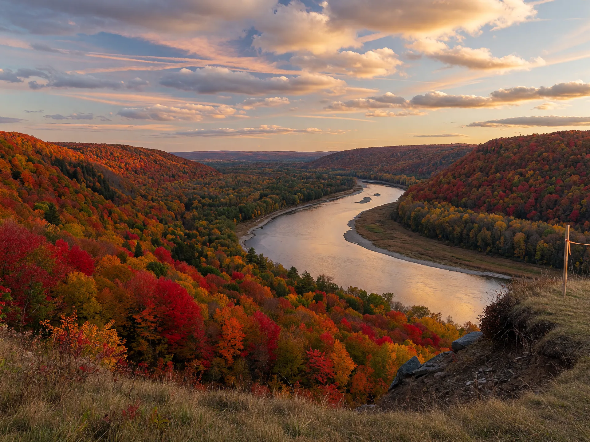
A bluff-top overlook above a river valley in autumn color

The St. Croix Valley

The bigger hikes around the river

The crown jewels of Washington County walking are the state parks and county reserves that hug the St. Croix River. These are the places where the pavement ends, the bluffs climb, and a two-hour hike feels like a day in the north woods.

William O'Brien State Park

About 12 miles of trails through rolling glacial hills, oak savanna, and wooded river bottomland at Marine on St. Croix. Named routes include the Riverside Trail (1.6-mile loop), Prairie Overlook Trail (1.4 miles round trip), Beaver Lodge Trail (0.7 miles), Wedge Hill Savanna Trail (1.5 miles), and the 5-mile Woodland Edge Trail.

  • MN state park permit required: $7/day or $35/year
MN DNR park page

Afton State Park

More than 20 miles of hiking trails across remnant prairies, oak savannas, and deep wooded ravines that drop up to 300 feet toward the river, with grassy ridgetops and overlooks of the St. Croix valley. The most dramatic walking in the county, and a favorite for fall color.

  • MN state park permit required: $7/day or $35/year
MN DNR park page

Big Marine Park Reserve

Roughly 1,800 acres near Marine on St. Croix, most of it kept as natural preservation land with about 1.5 miles of quiet hiking trails and lake access to Big Marine Lake. If your goal is solitude over mileage, this is the spot.

  • County vehicle permit required: $7/day or $30/year
Washington County park page

St. Croix Bluffs Regional Park

At the south end of the county near Hastings: 579 acres of forest and upland prairie with about 10 miles of hiking trails and a roughly 3.9-mile loop along the bluffs, plus groomed cross-country ski trails in winter.

  • County vehicle permit required: $7/day or $30/year
Washington County park page

The St. Croix National Scenic Riverway

The river itself is a national park: the St. Croix National Scenic Riverway, managed by the National Park Service. The riverway maintains seven day-use hiking trails, and while none have trailheads directly in Stillwater or Hudson, the Ridge View Trail near Osceola, Wisconsin (about 3 miles, two loops off County Road S) is the closest to Hudson, and the St. Croix Trail near Pine City (about 12 miles one way, between Snake River Landing and Old Railroad Bridge Landing) is the closest to Stillwater's north. The riverway is free to explore, and it is also where the Stillwater-area trails the states and county run pick up their story. NPS hiking page

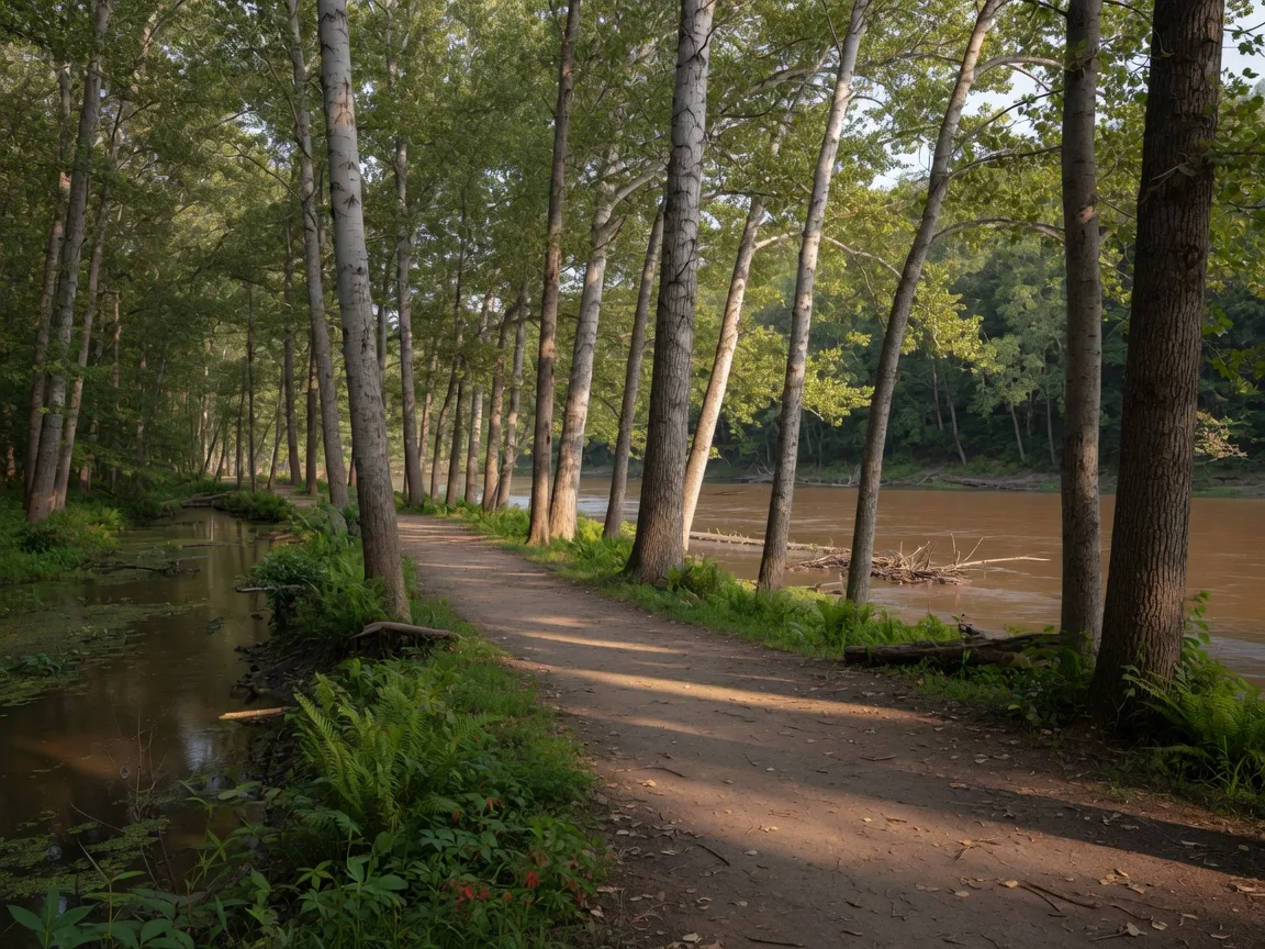
A wooded trail winding through tall trees near the Mississippi River

A Nearby Favorite

A longer nature walk just across the county line

Some of the best walks near our lake towns are a short drive away, and this one is mine for a longer nature walk.

Crosby Farm Regional Park

When I want a longer nature walk with real river views, I head to Crosby Farm. The largest natural park in the St. Paul park system, at 2595 Crosby Farm Road, sits right on the Mississippi River floodplain between Hidden Falls and Lilydale Regional Parks. About 6.7 miles of paved, wheelchair-accessible trails wind through shady floodplain forest, wetlands, and quiet backwater lakes, and along the river itself, so it never feels like a city walk. Locals walk, run, and bike here year-round, and the trails connect on to Watergate Marina and Hidden Falls if you want to keep going.

City of Saint Paul park page
  • ~6.7 miles, paved trails
  • 2595 Crosby Farm Rd, St. Paul
  • Trails connect to Hidden Falls & Watergate Marina

Year-Round

A year on the trails

Every season changes the walk, and locals have their favorites.

Spring

Ice-out on the lakes, mud on the natural trails. Stick to the paved paths and crushed rock until the ground firms up.

Summer

Walk early, then hit a swim pond or beach. The lakefront paths are at their best in the long evening light.

Fall

The payoff season. The bluffs along the St. Croix put on the best show in the metro, usually peaking in early to mid October.

Winter

Snowshoe at Tamarack Nature Center, ski the groomed trails at Lake Elmo Park Reserve and St. Croix Bluffs, or walk the paved trails once they are packed down.

Good to know: parking, permits, and manners

Minnesota state parks (Afton, William O'Brien) require a vehicle permit: $7 for a day, $35 for a year, good at every Minnesota state park. Buy it online or at the park.

Wisconsin state parks (Willow River) require a vehicle admission sticker: day passes were $13 with Wisconsin plates and $16 out-of-state in 2025, with annual passes at $28 and $38. Rates are set by the state, so check current pricing before you go.

Washington County park reserves (Lake Elmo, Big Marine, St. Croix Bluffs) require a vehicle permit: $7 for a day or $30 for a year, the annual pass honored at Anoka County parks too. No permit is needed along the Hardwood Creek Trail itself, and the county runs free admission days through the year.

City parks and rail trails (Mark Sather, Matoska, Pioneer, Lowell, Lakeside Memorial, Lakefront Park, Gateway, Brown's Creek, Hardwood Creek, and St. Paul's Crosby Farm) are free to walk.

Trail courtesy: leash dogs where posted, step aside for faster riders on the paved trails, and carry out what you carry in. The parks stay friendly when everyone shares them.

County parks & permits: Washington County State trail info: MN DNR State park permits: MN DNR permits WI admission passes: Wisconsin DNR Riverway hiking: National Park Service

Did we miss your favorite?

This guide covers the trails we could verify against the agencies that run them. Found a hidden gem or a section that changed? Tell us and we will check it out.

Your info stays yours. We never sell personal data to third parties. Privacy Policy